
Thank you for supporting this site ❤️
Make a donation
Make a donation
Bad Elster topographic map
Click on the map to display elevation.
Thank you for supporting this site ❤️
Make a donation
Make a donation
About this map
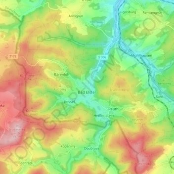
Name: Bad Elster topographic map, elevation, terrain.
Location: Bad Elster, Vogtlandkreis, Saxony, 08645, Germany (50.25888 12.19508 50.30712 12.29443)
Average elevation: 562 m
Minimum elevation: 447 m
Maximum elevation: 705 m
Thank you for supporting this site ❤️
Make a donation
Make a donation