
Thank you for supporting this site ❤️
Make a donation
Make a donation
Bovenden topographic map
Click on the map to display elevation.
Thank you for supporting this site ❤️
Make a donation
Make a donation
About this map
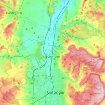
Name: Bovenden topographic map, elevation, terrain.
Location: Bovenden, Landkreis Göttingen, Lower Saxony, 37120, Germany (51.55964 9.81544 51.62573 10.07070)
Average elevation: 231 m
Minimum elevation: 119 m
Maximum elevation: 437 m
Thank you for supporting this site ❤️
Make a donation
Make a donation
Other topographic maps
Click on a map to view its topography, its elevation and its terrain.