
Thank you for supporting this site ❤️
Make a donation
Make a donation
Lüneburg topographic map
Click on the map to display elevation.
Thank you for supporting this site ❤️
Make a donation
Make a donation
About this map
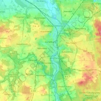
Name: Lüneburg topographic map, elevation, terrain.
Location: Lüneburg, Landkreis Lüneburg, Lower Saxony, Germany (53.19164 10.33100 53.28648 10.51438)
Average elevation: 35 m
Minimum elevation: 5 m
Maximum elevation: 82 m
Thank you for supporting this site ❤️
Make a donation
Make a donation