
Make a donation
Pico Simón Bolívar topographic map
Click on the map to display elevation.
Make a donation
Pico Simón Bolívar
Pico Simón Bolívar is possibly the highest mountain in Colombia, with an estimated height of 5,720 metres (18,770 ft). Pico Bolívar and the neighbouring summit of Pico Cristóbal Colón are the two highest peaks in Colombia and are very nearly equal in elevation. The height difference is about 7 meters. For this reason, it is the fifth most prominent peak in the world (see list of peaks by prominence). The nearest peak that is higher is Cayambe, some 1,288 kilometres (800 mi) away. There is a permanent snowcap on this peak and on the nearby mountains. It is part of the Sierra Nevada de Santa Marta range, along with Pico Cristóbal Colón. The peak is named after Simón Bolívar.
Make a donation
About this map
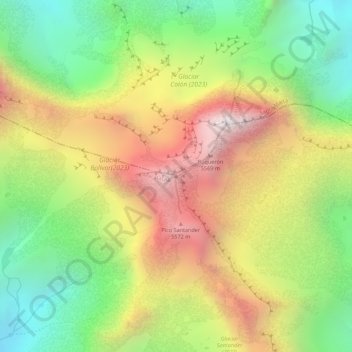
Name: Pico Simón Bolívar topographic map, elevation, terrain.
Location: Pico Simón Bolívar, Aracataca, Magdalena, Colombia (10.83482 -73.69057 10.83492 -73.69047)
Average elevation: 5,174 m
Minimum elevation: 4,679 m
Maximum elevation: 5,694 m
Make a donation