
Thank you for supporting this site ❤️
Make a donation
Make a donation
Undersåker topographic map
Click on the map to display elevation.
Thank you for supporting this site ❤️
Make a donation
Make a donation
About this map
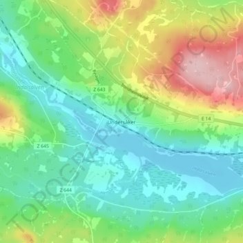
Name: Undersåker topographic map, elevation, terrain.
Location: Undersåker, Åre kommun, Provinz Jämtland, 837 96, Schweden (63.29469 13.22205 63.33469 13.26205)
Average elevation: 418 m
Minimum elevation: 360 m
Maximum elevation: 540 m
Thank you for supporting this site ❤️
Make a donation
Make a donation
Other topographic maps
Click on a map to view its topography, its elevation and its terrain.
Thank you for supporting this site ❤️
Make a donation
Make a donation
Thank you for supporting this site ❤️
Make a donation
Make a donation