
Thank you for supporting this site ❤️
Make a donation
Make a donation
Zgierz topographic map
Click on the map to display elevation.
Thank you for supporting this site ❤️
Make a donation
Make a donation
About this map
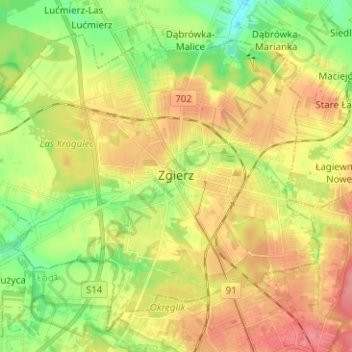
Name: Zgierz topographic map, elevation, terrain.
Location: Zgierz, Zgierz County, Łódź Voivodeship, Poland (51.82149 19.33139 51.88972 19.45674)
Average elevation: 191 m
Minimum elevation: 157 m
Maximum elevation: 227 m
Thank you for supporting this site ❤️
Make a donation
Make a donation