
Thank you for supporting this site ❤️
Make a donation
Make a donation
Virgin topographic map
Click on the map to display elevation.
Thank you for supporting this site ❤️
Make a donation
Make a donation
Virgin
Virgin is a town in Washington County, Utah, United States. The population was 596 at the 2010 census. The first settlement at Virgin was made in 1858. It is located along the Virgin River (for which it is named), and not far from Zion National Park. The elevation is 3,606 feet (1,099 m). It lies on State Route 9.
Thank you for supporting this site ❤️
Make a donation
Make a donation
About this map
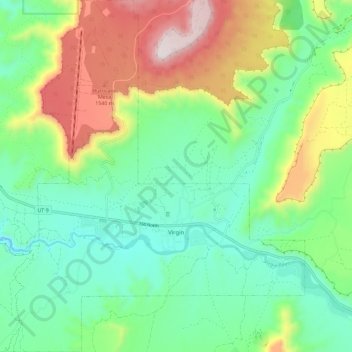
Name: Virgin topographic map, elevation, terrain.
Location: Virgin, Washington County, Utah, United States (37.17063 -113.25585 37.26243 -113.14567)
Average elevation: 1,251 m
Minimum elevation: 1,003 m
Maximum elevation: 1,758 m
Thank you for supporting this site ❤️
Make a donation
Make a donation