
Thank you for supporting this site ❤️
Make a donation
Make a donation
Sengkurong A topographic map
Click on the map to display elevation.
Thank you for supporting this site ❤️
Make a donation
Make a donation
About this map
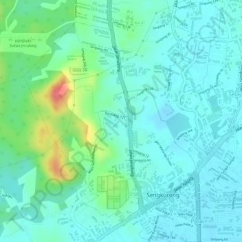
Name: Sengkurong A topographic map, elevation, terrain.
Location: Sengkurong A, Mukim Sengkurong, Brunei-Muara District, Brunei (4.88443 114.82554 4.90659 114.84963)
Average elevation: 21 m
Minimum elevation: 2 m
Maximum elevation: 79 m
Thank you for supporting this site ❤️
Make a donation
Make a donation
Other topographic maps
Click on a map to view its topography, its elevation and its terrain.