
Thank you for supporting this site ❤️
Make a donation
Make a donation
Hudiksvalls kommun topographic map
Click on the map to display elevation.
Thank you for supporting this site ❤️
Make a donation
Make a donation
About this map
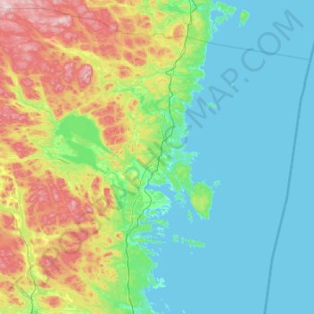
Name: Hudiksvalls kommun topographic map, elevation, terrain.
Location: Hudiksvalls kommun, Gävleborg County, Sweden (61.37166 16.06513 62.22696 18.00904)
Average elevation: 95 m
Minimum elevation: -2 m
Maximum elevation: 547 m
Thank you for supporting this site ❤️
Make a donation
Make a donation
Other topographic maps
Click on a map to view its topography, its elevation and its terrain.