
Thank you for supporting this site ❤️
Make a donation
Make a donation
Campamento topographic map
Click on the map to display elevation.
Thank you for supporting this site ❤️
Make a donation
Make a donation
Campamento
Campamento is a town and municipality in the Colombian department of Antioquia. Part of the subregion of Northern Antioquia, it lies at an altitude of 1,700 m (5,600 ft) above sea level. It is a little town, in the middle of the Andes.It borders on the north with the municipalities of Yarumal and Anorí, on the east with Anorí, on the south with the municipality of Angostura, and on the west with Yarumal.
Thank you for supporting this site ❤️
Make a donation
Make a donation
About this map
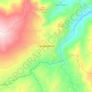
Name: Campamento topographic map, elevation, terrain.
Average elevation: 1,607 m
Minimum elevation: 954 m
Maximum elevation: 2,444 m
Thank you for supporting this site ❤️
Make a donation
Make a donation