
Sora topographic map
Interactive map
Click on the map to display elevation.
About this map
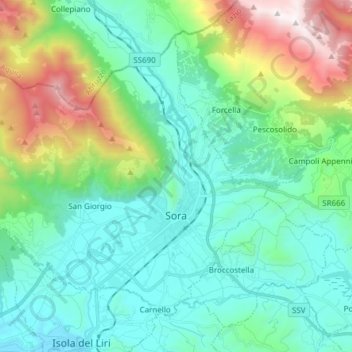
Name: Sora topographic map, elevation, terrain.
Location: Sora, Frosinone, Lazio, 03039, Italy (41.68789 13.50279 41.77808 13.65464)
Average elevation: 605 m
Minimum elevation: 209 m
Maximum elevation: 1,881 m