
Thank you for supporting this site ❤️
Make a donation
Make a donation
Slættafjall topographic map
Click on the map to display elevation.
Thank you for supporting this site ❤️
Make a donation
Make a donation
About this map
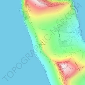
Name: Slættafjall topographic map, elevation, terrain.
Location: Slættafjall, Mikladalur, Norðoya sýsla, 797, Færøerne (62.33162 -6.78942 62.33172 -6.78932)
Average elevation: 145 m
Minimum elevation: -1 m
Maximum elevation: 602 m
Thank you for supporting this site ❤️
Make a donation
Make a donation