
Thank you for supporting this site ❤️
Make a donation
Make a donation
Markranstädt topographic map
Click on the map to display elevation.
Thank you for supporting this site ❤️
Make a donation
Make a donation
About this map
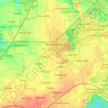
Name: Markranstädt topographic map, elevation, terrain.
Location: Markranstädt, Landkreis Leipzig, Saxony, 04420, Germany (51.23844 12.14779 51.34704 12.28132)
Average elevation: 122 m
Minimum elevation: 96 m
Maximum elevation: 141 m
Thank you for supporting this site ❤️
Make a donation
Make a donation