
Thank you for supporting this site ❤️
Make a donation
Make a donation
Sanem topographic map
Click on the map to display elevation.
Thank you for supporting this site ❤️
Make a donation
Make a donation
About this map
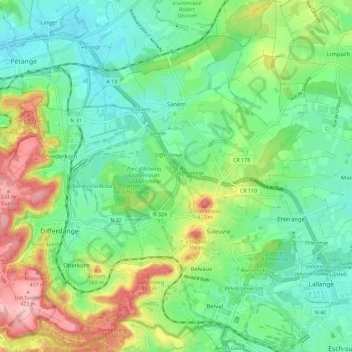
Name: Sanem topographic map, elevation, terrain.
Location: Sanem, Canton Esch-sur-Alzette, Luxembourg (49.49518 5.89854 49.56944 5.97664)
Average elevation: 322 m
Minimum elevation: 271 m
Maximum elevation: 426 m
Thank you for supporting this site ❤️
Make a donation
Make a donation
Other topographic maps
Click on a map to view its topography, its elevation and its terrain.