
Thank you for supporting this site ❤️
Make a donation
Make a donation
Llandrindod Wells topographic map
Click on the map to display elevation.
Thank you for supporting this site ❤️
Make a donation
Make a donation
About this map
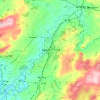
Name: Llandrindod Wells topographic map, elevation, terrain.
Location: Llandrindod Wells, Powys, Wales, LD1 5ET, United Kingdom (52.20052 -3.41936 52.28052 -3.33936)
Average elevation: 247 m
Minimum elevation: 148 m
Maximum elevation: 438 m
Thank you for supporting this site ❤️
Make a donation
Make a donation
Other topographic maps
Click on a map to view its topography, its elevation and its terrain.