
Thank you for supporting this site ❤️
Make a donation
Make a donation
Gøtunestindur topographic map
Click on the map to display elevation.
Thank you for supporting this site ❤️
Make a donation
Make a donation
About this map
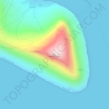
Name: Gøtunestindur topographic map, elevation, terrain.
Location: Gøtunestindur, Norðragøta, Eysturoyar sýsla, 512, Færøerne (62.18938 -6.64839 62.18948 -6.64829)
Average elevation: 115 m
Minimum elevation: -22 m
Maximum elevation: 627 m
Thank you for supporting this site ❤️
Make a donation
Make a donation