
Thank you for supporting this site ❤️
Make a donation
Make a donation
Castelo de Vide topographic map
Click on the map to display elevation.
Thank you for supporting this site ❤️
Make a donation
Make a donation
About this map
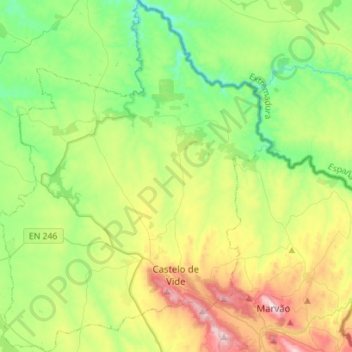
Name: Castelo de Vide topographic map, elevation, terrain.
Location: Castelo de Vide, Portalegre, Portugal (39.36766 -7.59817 39.58415 -7.37867)
Average elevation: 368 m
Minimum elevation: 131 m
Maximum elevation: 852 m
Thank you for supporting this site ❤️
Make a donation
Make a donation
Other topographic maps
Click on a map to view its topography, its elevation and its terrain.