
Thank you for supporting this site ❤️
Make a donation
Make a donation
Valle Nevado topographic map
Click on the map to display elevation.
Thank you for supporting this site ❤️
Make a donation
Make a donation
Valle Nevado
Due to its elevation, Valle Nevado has a subalpine climate (Dfc, according to the Köppen climate classification, bordering on Dfb and ET), with drier summers and humid winters, with an average annual precipitation of 1,042 mm (41 in). Summers are chilly and dry, while winters are cold and snowy.
Thank you for supporting this site ❤️
Make a donation
Make a donation
About this map
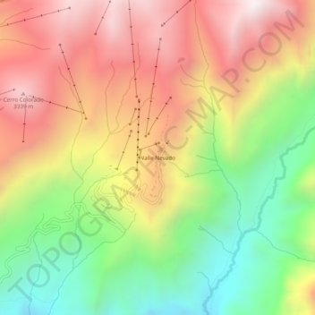
Name: Valle Nevado topographic map, elevation, terrain.
Average elevation: 2,811 m
Minimum elevation: 2,173 m
Maximum elevation: 3,442 m
Thank you for supporting this site ❤️
Make a donation
Make a donation