
Thank you for supporting this site ❤️
Make a donation
Make a donation
Hinwil topographic map
Click on the map to display elevation.
Thank you for supporting this site ❤️
Make a donation
Make a donation
About this map
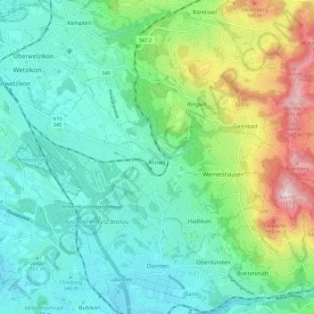
Name: Hinwil topographic map, elevation, terrain.
Location: Hinwil, Bezirk Hinwil, Zurich, Switzerland (47.27875 8.80377 47.32668 8.90979)
Average elevation: 652 m
Minimum elevation: 490 m
Maximum elevation: 1,112 m
Thank you for supporting this site ❤️
Make a donation
Make a donation