
Thank you for supporting this site ❤️
Make a donation
Make a donation
Cressier (FR) topographic map
Click on the map to display elevation.
Thank you for supporting this site ❤️
Make a donation
Make a donation
About this map
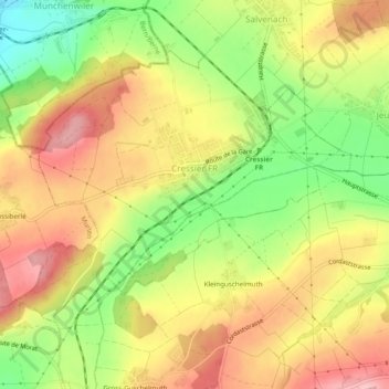
Name: Cressier (FR) topographic map, elevation, terrain.
Location: Cressier (FR), See District, Fribourg, 1785, Switzerland (46.88410 7.11289 46.90864 7.16121)
Average elevation: 565 m
Minimum elevation: 479 m
Maximum elevation: 639 m
Thank you for supporting this site ❤️
Make a donation
Make a donation
Other topographic maps
Click on a map to view its topography, its elevation and its terrain.