
Thank you for supporting this site ❤️
Make a donation
Make a donation
Thurø topographic map
Click on the map to display elevation.
Thank you for supporting this site ❤️
Make a donation
Make a donation
About this map
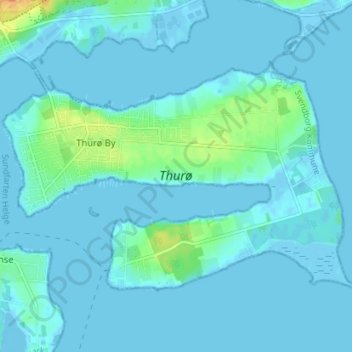
Name: Thurø topographic map, elevation, terrain.
Location: Thurø, Thurø By, Svendborg Kommune, Region Syddanmark, Danmark (55.02932 10.64701 55.05585 10.71791)
Average elevation: 4 m
Minimum elevation: -7 m
Maximum elevation: 34 m
Thank you for supporting this site ❤️
Make a donation
Make a donation