
Thank you for supporting this site ❤️
Make a donation
Make a donation
Odesa Oblast topographic map
Click on the map to display elevation.
Thank you for supporting this site ❤️
Make a donation
Make a donation
About this map
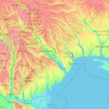
Name: Odesa Oblast topographic map, elevation, terrain.
Location: Odesa Oblast, Ukraine (45.05320 28.21383 48.23329 31.30498)
Average elevation: 86 m
Minimum elevation: -8 m
Maximum elevation: 415 m
Thank you for supporting this site ❤️
Make a donation
Make a donation
Other topographic maps
Click on a map to view its topography, its elevation and its terrain.