
Thank you for supporting this site ❤️
Make a donation
Make a donation
Lindon topographic map
Click on the map to display elevation.
Thank you for supporting this site ❤️
Make a donation
Make a donation
About this map
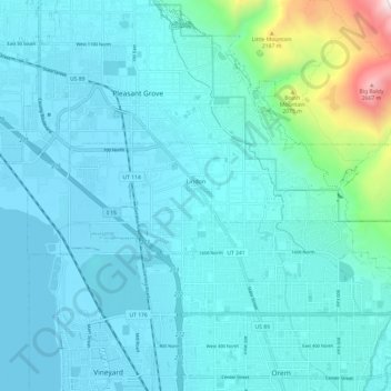
Name: Lindon topographic map, elevation, terrain.
Location: Lindon, Utah County, Utah, 84042, United States (40.32602 -111.77905 40.35363 -111.65812)
Average elevation: 1,537 m
Minimum elevation: 1,366 m
Maximum elevation: 2,822 m
Thank you for supporting this site ❤️
Make a donation
Make a donation
Other topographic maps
Click on a map to view its topography, its elevation and its terrain.
Thank you for supporting this site ❤️
Make a donation
Make a donation
Thank you for supporting this site ❤️
Make a donation
Make a donation
Thank you for supporting this site ❤️
Make a donation
Make a donation