
Thank you for supporting this site ❤️
Make a donation
Make a donation
Mogata topographic map
Click on the map to display elevation.
Thank you for supporting this site ❤️
Make a donation
Make a donation
About this map
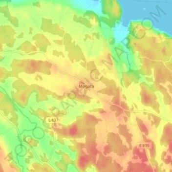
Name: Mogata topographic map, elevation, terrain.
Location: Mogata, Söderköpings kommun, Östergötland County, Sweden (58.43113 16.43179 58.47113 16.47179)
Average elevation: 31 m
Minimum elevation: 0 m
Maximum elevation: 53 m
Thank you for supporting this site ❤️
Make a donation
Make a donation
Other topographic maps
Click on a map to view its topography, its elevation and its terrain.