
Thank you for supporting this site ❤️
Make a donation
Make a donation
Tula del Río topographic map
Click on the map to display elevation.
Thank you for supporting this site ❤️
Make a donation
Make a donation
About this map
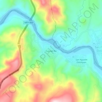
Name: Tula del Río topographic map, elevation, terrain.
Location: Tula del Río, Mártir de Cuilapan, Guerrero, México (17.90444 -99.38083 17.94444 -99.34083)
Average elevation: 647 m
Minimum elevation: 502 m
Maximum elevation: 907 m
Thank you for supporting this site ❤️
Make a donation
Make a donation