
Thank you for supporting this site ❤️
Make a donation
Make a donation
Tekkeköy topographic map
Click on the map to display elevation.
Thank you for supporting this site ❤️
Make a donation
Make a donation
Tekkeköy
The Hacı Osman grove, which stretches along the coast, Kapaklı Pınar, Kırantepe, Azman, and Asarağaç hills at 700 to 800 m altitudes are popular spots for picnicking and other recreational activities.
Thank you for supporting this site ❤️
Make a donation
Make a donation
About this map
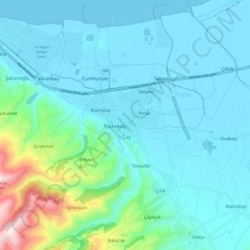
Name: Tekkeköy topographic map, elevation, terrain.
Location: Tekkeköy, Samsun, Black Sea Region, 55300, Turkey (41.17350 36.41780 41.25350 36.49780)
Average elevation: 114 m
Minimum elevation: 0 m
Maximum elevation: 668 m
Thank you for supporting this site ❤️
Make a donation
Make a donation