
Thank you for supporting this site ❤️
Make a donation
Make a donation
Qarnayel topographic map
Click on the map to display elevation.
Thank you for supporting this site ❤️
Make a donation
Make a donation
About this map
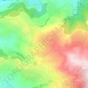
Name: Qarnayel topographic map, elevation, terrain.
Location: Qarnayel, Baabda District, Mount Lebanon Governorate, Lebanon (33.83576 35.70757 33.87576 35.74757)
Average elevation: 1,068 m
Minimum elevation: 665 m
Maximum elevation: 1,520 m
Thank you for supporting this site ❤️
Make a donation
Make a donation
Other topographic maps
Click on a map to view its topography, its elevation and its terrain.