
Make a donation
Popocatépetl topographic map
Click on the map to display elevation.
Make a donation
Popocatépetl
According to paleomagnetic studies, the volcano is about 730,000 years old. It is cone shaped with a diameter of 25 km (16 mi) at its base, with a peak elevation of 5,450 m (17,880 ft). The crater is elliptical with an orientation northeast-southwest. The walls of the crater vary from 600 to 840 m (1,970 to 2,760 ft) in height. Popocatépetl is currently active after being dormant for about half of last century. Its activity increased in 1991 and smoke has been seen constantly emanating from the crater since 1993. The volcano is monitored by the Deep Earth Carbon Degassing Project.
Make a donation
About this map
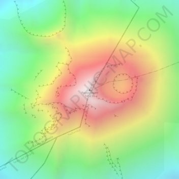
Name: Popocatépetl topographic map, elevation, terrain.
Location: Popocatépetl, Tochimilco, Puebla, Mexico (19.02336 -98.62349 19.02346 -98.62339)
Average elevation: 4,807 m
Minimum elevation: 4,226 m
Maximum elevation: 5,409 m
Make a donation