
Thank you for supporting this site ❤️
Make a donation
Make a donation
Hoppegarten topographic map
Click on the map to display elevation.
Thank you for supporting this site ❤️
Make a donation
Make a donation
About this map
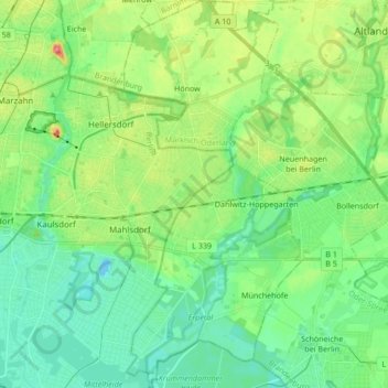
Name: Hoppegarten topographic map, elevation, terrain.
Location: Hoppegarten, Märkisch-Oderland, Brandenburg, Germany (52.46645 13.61059 52.56948 13.68877)
Average elevation: 52 m
Minimum elevation: 30 m
Maximum elevation: 104 m
Thank you for supporting this site ❤️
Make a donation
Make a donation
Other topographic maps
Click on a map to view its topography, its elevation and its terrain.
Birkenstein
Germany > Brandenburg > Märkisch-Oderland > Hoppegarten > Dahlwitz-Hoppegarten
Average elevation: 55 m