
Thank you for supporting this site ❤️
Make a donation
Make a donation
Älmeboda topographic map
Click on the map to display elevation.
Thank you for supporting this site ❤️
Make a donation
Make a donation
About this map
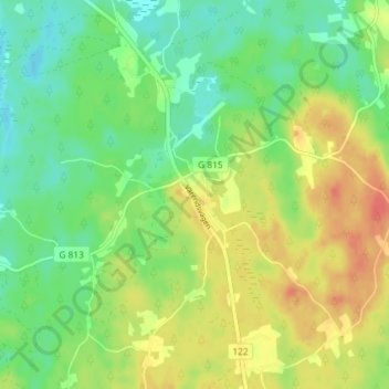
Name: Älmeboda topographic map, elevation, terrain.
Location: Älmeboda, Tingsryds kommun, Kronobergs län, 362 98, Zweden (56.56997 15.22994 56.60997 15.26994)
Average elevation: 151 m
Minimum elevation: 129 m
Maximum elevation: 180 m
Thank you for supporting this site ❤️
Make a donation
Make a donation
Other topographic maps
Click on a map to view its topography, its elevation and its terrain.