
Thank you for supporting this site ❤️
Make a donation
Make a donation
Çitören topographic map
Click on the map to display elevation.
Thank you for supporting this site ❤️
Make a donation
Make a donation
About this map
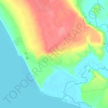
Name: Çitören topographic map, elevation, terrain.
Location: Çitören, Tuşba, Van, Eastern Anatolia Region, Turkey (38.58006 43.19658 38.62006 43.23658)
Average elevation: 1,675 m
Minimum elevation: 1,643 m
Maximum elevation: 1,728 m
Thank you for supporting this site ❤️
Make a donation
Make a donation