
Thank you for supporting this site ❤️
Make a donation
Make a donation
Corbin topographic map
Click on the map to display elevation.
Thank you for supporting this site ❤️
Make a donation
Make a donation
About this map
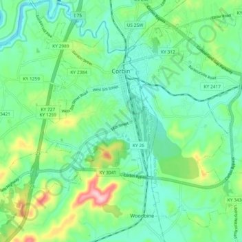
Name: Corbin topographic map, elevation, terrain.
Location: Corbin, Whitley County, Kentucky, United States (36.90125 -84.14230 36.96585 -84.05063)
Average elevation: 360 m
Minimum elevation: 304 m
Maximum elevation: 514 m
Thank you for supporting this site ❤️
Make a donation
Make a donation
Other topographic maps
Click on a map to view its topography, its elevation and its terrain.