
Thank you for supporting this site ❤️
Make a donation
Make a donation
Oberursel (Taunus) topographic map
Click on the map to display elevation.
Thank you for supporting this site ❤️
Make a donation
Make a donation
Oberursel (Taunus)
Altitude
Thank you for supporting this site ❤️
Make a donation
Make a donation
About this map
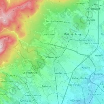
Name: Oberursel (Taunus) topographic map, elevation, terrain.
Location: Oberursel (Taunus), Hochtaunuskreis, Hesse, 61440, Germany (50.16732 8.45348 50.24527 8.63874)
Average elevation: 315 m
Minimum elevation: 99 m
Maximum elevation: 884 m
Thank you for supporting this site ❤️
Make a donation
Make a donation