
Ubud topographic map
Click on the map to display elevation.
About this map
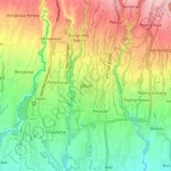
Name: Ubud topographic map, elevation, terrain.
Location: Ubud, Gianyar, Bali, Lesser Sunda Islands, 80571, Indonesia (-8.54690 115.22229 -8.46690 115.30229)
Average elevation: 215 m
Minimum elevation: 110 m
Maximum elevation: 357 m
Other topographic maps
Click on a map to view its topography, its elevation and its terrain.