
Thank you for supporting this site ❤️
Make a donation
Make a donation
Fjallið topographic map
Click on the map to display elevation.
Thank you for supporting this site ❤️
Make a donation
Make a donation
About this map
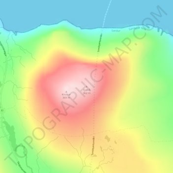
Name: Fjallið topographic map, elevation, terrain.
Location: Fjallið, Sandur, Sandoyar sýsla, 210, Færøerne (61.88839 -6.83823 61.88849 -6.83813)
Average elevation: 159 m
Minimum elevation: -6 m
Maximum elevation: 361 m
Thank you for supporting this site ❤️
Make a donation
Make a donation