
Drăgănești topographic map
Interactive map
Click on the map to display elevation.
About this map
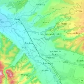
Name: Drăgănești topographic map, elevation, terrain.
Location: Drăgănești, Bihor, Romania (46.60192 22.36118 46.68041 22.49784)
Average elevation: 242 m
Minimum elevation: 174 m
Maximum elevation: 459 m