
Thank you for supporting this site ❤️
Make a donation
Make a donation
Pine Mountain topographic map
Click on the map to display elevation.
Thank you for supporting this site ❤️
Make a donation
Make a donation
About this map
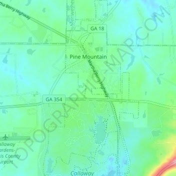
Name: Pine Mountain topographic map, elevation, terrain.
Location: Pine Mountain, Harris County, Georgia, United States (32.83003 -84.86985 32.88138 -84.83654)
Average elevation: 271 m
Minimum elevation: 244 m
Maximum elevation: 376 m
Thank you for supporting this site ❤️
Make a donation
Make a donation
Other topographic maps
Click on a map to view its topography, its elevation and its terrain.