
Thank you for supporting this site ❤️
Make a donation
Make a donation
Río Grande topographic map
Click on the map to display elevation.
Thank you for supporting this site ❤️
Make a donation
Make a donation
About this map
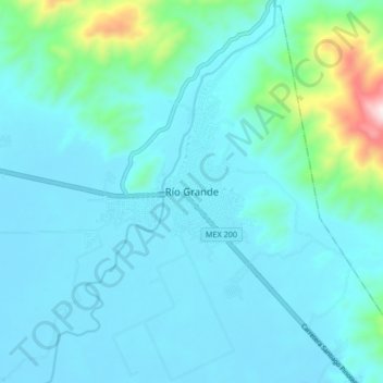
Name: Río Grande topographic map, elevation, terrain.
Location: Río Grande, Tututepec, Oaxaca, México (15.97142 -97.47467 16.05142 -97.39467)
Average elevation: 93 m
Minimum elevation: 6 m
Maximum elevation: 682 m
Thank you for supporting this site ❤️
Make a donation
Make a donation