
Thank you for supporting this site ❤️
Make a donation
Make a donation
Thôn 2 topographic map
Click on the map to display elevation.
Thank you for supporting this site ❤️
Make a donation
Make a donation
About this map
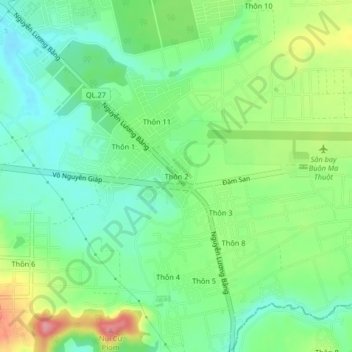
Name: Thôn 2 topographic map, elevation, terrain.
Location: Thôn 2, Phường Tân Lập, Đắk Lắk Province, 64113, Vietnam (12.64374 108.08285 12.68374 108.12285)
Average elevation: 516 m
Minimum elevation: 474 m
Maximum elevation: 595 m
Thank you for supporting this site ❤️
Make a donation
Make a donation