
Thank you for supporting this site ❤️
Make a donation
Make a donation
Clervaux topographic map
Click on the map to display elevation.
Thank you for supporting this site ❤️
Make a donation
Make a donation
About this map
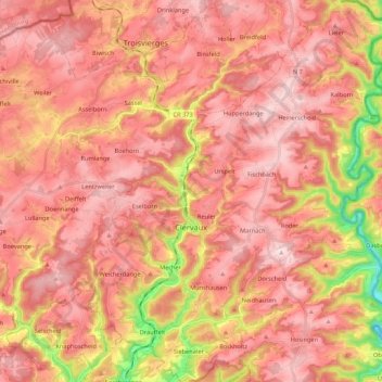
Name: Clervaux topographic map, elevation, terrain.
Location: Clervaux, Canton Clervaux, Luxembourg (49.99886 5.95691 50.13655 6.13784)
Average elevation: 452 m
Minimum elevation: 254 m
Maximum elevation: 546 m
Thank you for supporting this site ❤️
Make a donation
Make a donation
Other topographic maps
Click on a map to view its topography, its elevation and its terrain.