
Thank you for supporting this site ❤️
Make a donation
Make a donation
Åmnes topographic map
Click on the map to display elevation.
Thank you for supporting this site ❤️
Make a donation
Make a donation
About this map
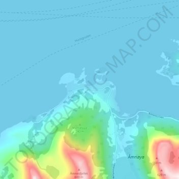
Name: Åmnes topographic map, elevation, terrain.
Location: Åmnes, Meløy, Nordland, Norvège (66.76372 13.34098 66.80372 13.38098)
Average elevation: 66 m
Minimum elevation: 0 m
Maximum elevation: 580 m
Thank you for supporting this site ❤️
Make a donation
Make a donation
Other topographic maps
Click on a map to view its topography, its elevation and its terrain.
Thank you for supporting this site ❤️
Make a donation
Make a donation
Thank you for supporting this site ❤️
Make a donation
Make a donation