
Thank you for supporting this site ❤️
Make a donation
Make a donation
Vørufelli topographic map
Click on the map to display elevation.
Thank you for supporting this site ❤️
Make a donation
Make a donation
About this map
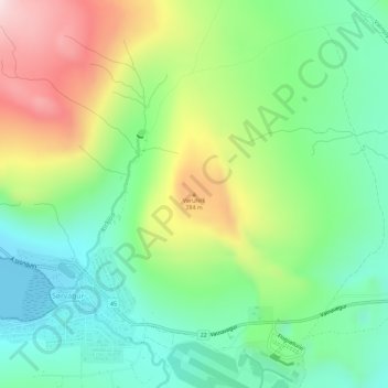
Name: Vørufelli topographic map, elevation, terrain.
Location: Vørufelli, Sørvágur, Vága sýsla, 380, Færøerne (62.07866 -7.29112 62.07876 -7.29102)
Average elevation: 151 m
Minimum elevation: 0 m
Maximum elevation: 419 m
Thank you for supporting this site ❤️
Make a donation
Make a donation