
Thank you for supporting this site ❤️
Make a donation
Make a donation
Bromölla topographic map
Click on the map to display elevation.
Thank you for supporting this site ❤️
Make a donation
Make a donation
About this map
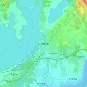
Name: Bromölla topographic map, elevation, terrain.
Location: Bromölla, Bromölla kommun, Escânia, 295 31, Suécia (56.03616 14.42817 56.11616 14.50817)
Average elevation: 12 m
Minimum elevation: -2 m
Maximum elevation: 95 m
Thank you for supporting this site ❤️
Make a donation
Make a donation
Other topographic maps
Click on a map to view its topography, its elevation and its terrain.