
Make a donation
Mġarr topographic map
Click on the map to display elevation.
Make a donation
About this map
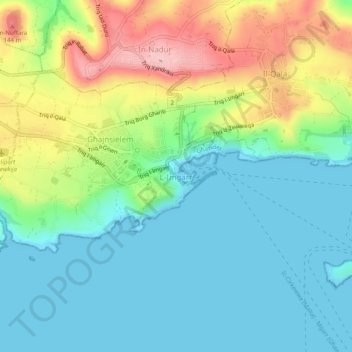
Name: Mġarr topographic map, elevation, terrain.
Location: Mġarr, Għajnsielem, Gozo Region, GHR 1022, Malta (36.00454 14.27640 36.04454 14.31640)
Average elevation: 50 m
Minimum elevation: -1 m
Maximum elevation: 161 m
Make a donation
Other topographic maps
Click on a map to view its topography, its elevation and its terrain.
Gozo
The University of Malta carried out geological and geophysical investigations in connection with a proposed sub-sea tunnel between Malta and Gozo following an agreement with Transport Malta. Scientific investigations included both desktop and field studies, passive seismic measurements, bathymetric mapping,…
Average elevation: 31 m
Make a donation
Gozo
Malta > Gozo Region > Xaghra
The University of Malta carried out geological and geophysical investigations in connection with a proposed sub-sea tunnel between Malta and Gozo following an agreement with Transport Malta. Scientific investigations included both desktop and field studies, passive seismic measurements, bathymetric mapping,…
Average elevation: 31 m