
Thank you for supporting this site ❤️
Make a donation
Make a donation
Hausham topographic map
Click on the map to display elevation.
Thank you for supporting this site ❤️
Make a donation
Make a donation
About this map
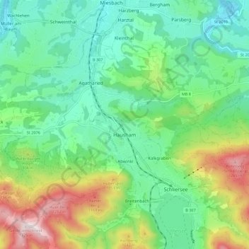
Name: Hausham topographic map, elevation, terrain.
Location: Hausham, Landkreis Miesbach, Bavaria, 83734, Germany (47.72695 11.78441 47.78060 11.89438)
Average elevation: 854 m
Minimum elevation: 649 m
Maximum elevation: 1,328 m
Thank you for supporting this site ❤️
Make a donation
Make a donation