
Thank you for supporting this site ❤️
Make a donation
Make a donation
Handöl topographic map
Click on the map to display elevation.
Thank you for supporting this site ❤️
Make a donation
Make a donation
About this map
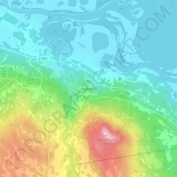
Name: Handöl topographic map, elevation, terrain.
Location: Handöl, Åre kommun, Jämtland County, Sweden (63.23327 12.43081 63.27327 12.47081)
Average elevation: 592 m
Minimum elevation: 524 m
Maximum elevation: 776 m
Thank you for supporting this site ❤️
Make a donation
Make a donation