
Thank you for supporting this site ❤️
Make a donation
Make a donation
Kvänarp topographic map
Click on the map to display elevation.
Thank you for supporting this site ❤️
Make a donation
Make a donation
About this map
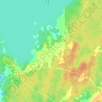
Name: Kvänarp topographic map, elevation, terrain.
Location: Kvänarp, Ljungby kommun, Kronoberg len, Sverige (56.93130 14.07028 56.97130 14.11028)
Average elevation: 162 m
Minimum elevation: 145 m
Maximum elevation: 182 m
Thank you for supporting this site ❤️
Make a donation
Make a donation
Other topographic maps
Click on a map to view its topography, its elevation and its terrain.