
Genting Highlands topographic map
Interactive map
Click on the map to display elevation.
Genting Highlands
Genting Highlands is a hill station located on the peak of Mount Ulu Kali in the Titiwangsa Mountains, central Peninsular Malaysia, at 1800 metres elevation. Located in the state of Pahang, it was established in 1965 by the late Malaysian businessman Lim Goh Tong. The primary tourist attraction is Resorts World Genting, a hill resort where casinos and theme parks are situated and where gambling is permitted. Many of Pahang's skyscrapers can be found here.
About this map
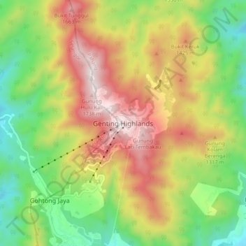
Name: Genting Highlands topographic map, elevation, terrain.
Location: Genting Highlands, Bentong, Pahang, 69000, Malaysia (3.42363 101.79335 3.42373 101.79345)
Average elevation: 1,517 m
Minimum elevation: 1,218 m
Maximum elevation: 1,762 m
Other topographic maps
Click on a map to view its topography, its elevation and its terrain.