
Gözucu topographic map
Interactive map
Click on the map to display elevation.
About this map
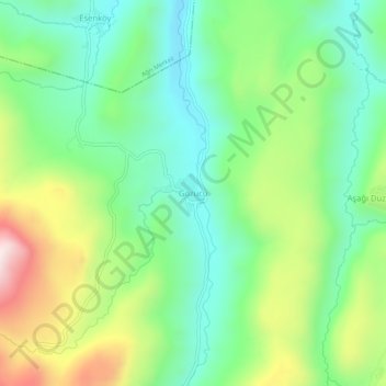
Name: Gözucu topographic map, elevation, terrain.
Location: Gözucu, Taşlıçay, Ağrı, Eastern Anatolia Region, Turkey (39.52784 43.26069 39.56784 43.30069)
Average elevation: 2,080 m
Minimum elevation: 1,859 m
Maximum elevation: 2,507 m