
Lake Sasykkol topographic map
Interactive map
Click on the map to display elevation.
About this map
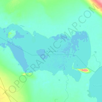
Name: Lake Sasykkol topographic map, elevation, terrain.
Average elevation: 357 m
Minimum elevation: 348 m
Maximum elevation: 466 m
Other topographic maps
Click on a map to view its topography, its elevation and its terrain.
Border Kazakhstan - Russia
Kazakhstan > East Kazakhstan Region > Katonkaragay District
Border Kazakhstan - Russia, Katonkaragay District, East Kazakhstan Region, Kazakhstan
Average elevation: 2,676 m
Уржар
Kazakhstan > East Kazakhstan Region
Уржар, , Урджарский район, East Kazakhstan Region, 040222, Kazakhstan
Average elevation: 352 m
Lake Zaysan
Kazakhstan > East Kazakhstan Region
Lake Zaysan, Kurshim District, East Kazakhstan Region, Kazakhstan
Average elevation: 562 m
Казахстан
Kazakhstan > East Kazakhstan Region > Казахстан
Казахстан, Kurshim District, East Kazakhstan Region, Kazakhstan
Average elevation: 436 m